HxGN Mass Transit
Micromobility solution/ M. App Portfolio/ Mass Transit Solution/ Luciad Portfolio / Power Portfolio. A geospatial transportation infrastructure management system with 3D and AI capabilities for visualizing and analyzing transit and rail assets and operations. HxGN Mass Transit serves as a single source of truth for infrastructure data, enabling rail-bound and transit operators to easily inspect, validate and share information on the fly.
Challenge:
Public transport networks are complex. An error or delay in one segment can cause a ripple effect and problems down the line – for both the transport provider and the public who depend on this critical service.
To manage this complexity, public transportation agencies rely on different data sources, from infrastructure to financial to work management. These data sources are frequently spread across multiple systems, departments and formats, and can’t be synchronised and viewed in real-time. This makes it difficult to have a holistic view on the conditions of the different assets and to prioritise and coordinate maintenance.
Solution:
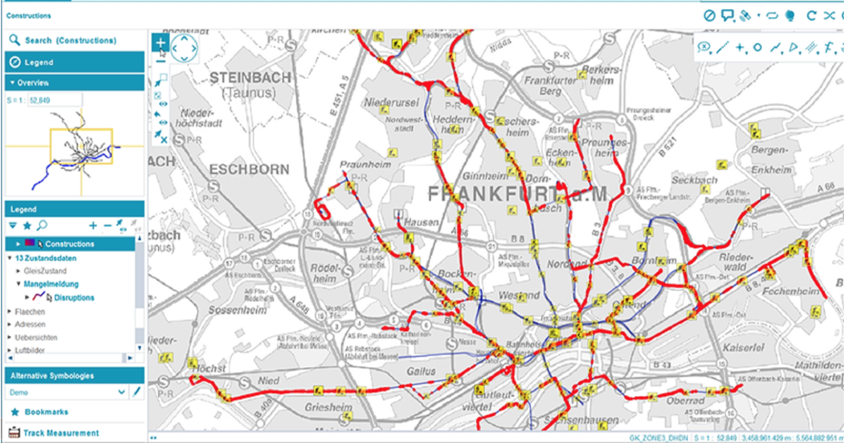
HxGN Mass Transit helps public transportation organisations to overcome these challenges and efficiently manage their data, workflows, and transit networks. By combining all asset and spatial data into an integrated transport network information system and common operational picture, organisations can avoid data duplication and ensure users have access to accurate and up-to-date information across the enterprise. Additionally, Hexagon’s 3D and AI capabilities allow departments to go beyond a simple map to create an advanced digital twin of their city’s entire public transportation system, from stops, track and switches to ticket machines, benches, and garbage cans.
Benefits:
Edit and access transportation network data
- Individuals across the entire public transportation organization can create data, maps, reports, and queries for their projects, instead of having to rely on GIS specialists.
Inspect and capture asset data in the field
- Service workers have complete access, anywhere and anytime, to the data they need to fulfill specific tasks or projects with the mobile app.
Analyze, monitor and predict infrastructure status
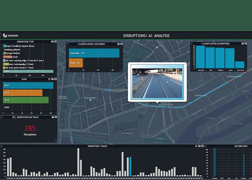
- Spatio-temporal dashboards provide accurate information in 2D and 3D, including the results of artificial intelligence algorithms for feature extraction and predictive maintenance.
HxGN Mass Transit is already delivering benefits to public transportation organizations.
“Every day, we transport more than 900,000 passengers around Zurich on our 510-kilometer network with 75 tram and bus lines,” said Daniel Steger, head of electrical infrastructure, Zurich Public Transport. “Maintaining our infrastructure is vital. HxGN Mass Transit will allow us to monitor rail tracks, overhead cables and the condition of bus stops to ensure we keep the citizens and visitors of Zurich moving.”
“HxGN Mass Transit is an essential tool for managing our assets,” said Dominik Rabenau, head of data management at VGF Frankfurt’s infrastructure division. “The mobile application provides easy monitoring and the ability to update information of our timetable displays located at all stations, platforms and stops.”